[تمّ الحل] اريد برنامج arc gis

ياريت اللى عنده البرنامج يبعتهولى ضرورى على الميل
او يرفعه
**************************
عذرا بتحرير الإيمايل لأنّ وضعه في المواضيع مخالف
حرّره المشرف
الزعيم الأول

**************************
 
هذا موضوع من منتدى أجنبي
أتمنى أن يفيدك :

ArcGIS%2010%20splash.jpg

Works with all native ESRI ArcGIS 10 extension,
including Data Interopability Extension.

=========
IMPORTANT
=========
IF YOU HAVE PREVIOUSLY INSTALLED LICENSE MANAGER (9.x or 10)
UNINSTALL IT BEFORE USING THIS MODIFIED VERSION OF LICENSE MANAGER!

THIS IS TWO STEP INSTALLATION, DO NOT CLOSE THE SECOND INSTALLATION WINDOW
the 1st step is modified license manager 10, and 2nd is cracked AfCore.dll v5.

DO NOT CHANGE THE INSTALLATION PATH.
LET IT BE IN C:\ (your root of your Windows system!) for the 1st installation step
and LET IT BE IN \Program Files\ArcGIS\Desktop10.0\Bin\ for the 2nd installation step

ON 2nd installation step, for Windows Vista and 7:
PLEASE ACCEPT (ALLOW ACCESS) TO LMGRD.EXE and ARCGIS.EXE IN WINDOWS FIREWALL SECURITY ALLERT WINDOW.

=======
CREDITS
=======
Our hero:
-TBE for patched arcgis.exe in License Manager and "37102011" license file.
-DJX for patched AfCore.dll v5 in ArcGIS\bin folder.

=====
NOTES
=====
this is just simplification method of what istigatore in LAVTeam does. thanks a lot for that.
the simplifications are:

1.
there is no more ugly DOS window appears during license manager running.
you can notice it is actually running in background, as lmgrd.exe in Task Manager

2.
automaticly start while Windows startup,
so there's no need to activate this modified server before you using ArcGIS

3.
there's a shortcut in Start Menu,
just in case it stopped and need to running again manually.

========
WARNING!
========
-DO NOT USE THIS CRACK FOR COMMERCIAL PURPOSE, THE CRACKER DOES NOT ALLOWED YOU TO DO THAT!
-THIS IS ONLY FOR EVALUATION PURPOSE!
-IF YOU WANT THIS SOFTWARE FOR COMMERCIAL USE, THEN BUY ORIGINAL SOFTWARE ALONG WITH THE ORIGINAL LICENSE KEY!
-RESPECT THE PROGRAMMER AND DEVELOPER, OF COURSE THEY NEED MONEY TO IMPROVE AND SUPPORT THIS GREAT GIS SOFTWARE!


uploaded by Sijooss credit goes to original craker

http://www.fileserve.com/file/5FsjMbV

http://www.fileserve.com/file/TppS29B
 
الموضوع السابق للكراك فقط
و البرنامج كامل لكن لإصدار : 9.2
في هذا الموضوع :

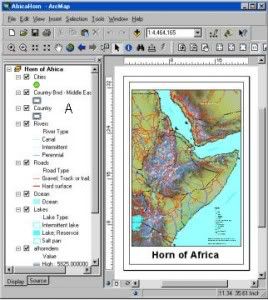
arctop_285.jpg


ArcGIS Desktop is a collection of software products that runs on standard desktop computers. It is used to create, import, edit, query, map, analyze, and publish geographic information. There are four products in the ArcGIS Desktop collection; each adds a higher level of functionality.

ArcReader is a free viewer for maps authored using the other ArcGIS Desktop products. It can view and print all maps and data types. It also has some simple tools to explore and query maps.

ArcView provides extensive mapping, data use, and analysis along with simple editing and geoprocessing capabilities.

ArcEditor includes advanced editing for shapefiles and geodatabases in addition to the full functionality of ArcView.

ArcInfo is the full function, flagship GIS desktop. It extends the functionality of both ArcView and ArcEditor with advanced geoprocessing. It also includes the legacy applications for ArcInfo Workstation.

All ArcGIS Desktop products share a common architecture, so users working with any of these GIS desktops can share their work with others. Maps, data, symbology, map layers, geoprocessing models, custom tools and interfaces, reports, metadata, and so on, can be accessed interchangeably. This means that all GIS users in an organization can benefit from using a single, consistent user interface and set of functionality and data formats, thus minimizing the need to learn and deploy several different products.

In addition, maps, data, and metadata created with ArcGIS Desktop can be shared with many users through the use of custom ArcGIS Engine applications and advanced GIS web services using ArcIMS and ArcGIS Server.

http://hotfile.com/list/356527/8a0b497
 
عودة
أعلى